Wednesday, August 8, 2012

Port Denison

Thursday, 19 July 2012

Port Denison is a twin town with Dongara, both only 65-70kms south of Geraldton.
We decided to make this our base for a couple of weeks to wait for the wildflowers to bloom and also to get the ute serviced in Geraldton.

Port Denison is a pretty, quiet seaside fishing town where we could do a bit of fishing, well try anyway, have walks along the beach and take some great photos.

Our stay became extended when a storm hit while we were in Geraldton getting the ute serviced and the awning on the van was torn so we had to order a replacement cover and wait for it to be delivered and installed.

While waiting we took a couple of drives, one to Greenough an old historic village with lovely stone buildings, a convict built bridge and much to Crawf's delight, an antique fair at the Hampton Arms Inn.  We also took a picnic lunch and travelled inland to Ellendale Pool, where we found a very pretty waterhole with a campground and picnic area.
St Francis Xavier Cathedral, Geraldton, WA
Geraldton, WA


Port Denison, WA


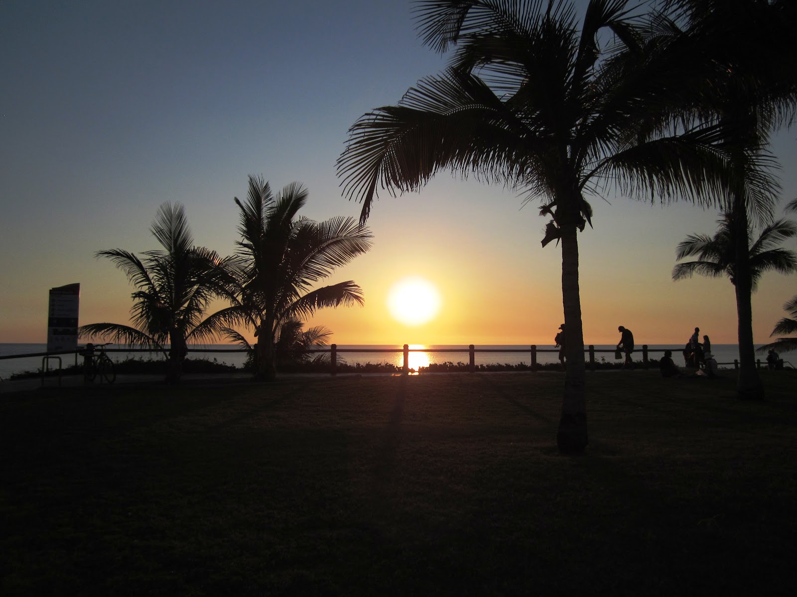
Sunset, Port Denison, WA


Crab, Port Denison
Crab, Port Denison
Ellendale Pool, WA


Sunday, July 29, 2012

Waiting for the Wildflowers

Perth, again.
We spent ten days at Kingsley, a northern suburb of Perth.
As we had been to Perth last year and had seen most of the sights we used this time to relax and see some of the coast to the north of the city.
The Pinnacles, near Cervantes, WA

Tuesday, 17 July 2012
The Pinnacles, near Cervantes, WA
We successfully exited the caravan park at Kingsley after some tricky driving manoeuvres by Crawf. We visited some of the small coastal towns on our way to Cervantes.
The Pinnacles, near Cervantes, WA
Cervantes is also a small seaside town which is most famous for being the closest and most convenient town to the brilliant "Pinnacles". The Pinnacles are millions of varying shaped rocks literally sticking out of the desert. From a distance they resemble a huge graveyard of headstones. There are several schools of thought as to how they were formed varying from a dead forest of fossilized tree trunks to chemical reactions between water and shells etc. We walked around amongst the rocks and were able to see some very tiny pinnacles which are forming in the sand.
The Pinnacles, near Cervantes, WA
The Pinnacles, WA
While in this area we also visited Lake Thetis where we saw some more stromatolites.

Saturday, July 14, 2012

Shark Bay area

Thursday, 28 June 2012 to Friday, 29 June 2012

We chose to stay at Hamelin Station Stay, a working sheep station about 100kms from Denham. They have a great caravan, camping area which is only a couple of kilometres from Hamelin Pool where some very rare and interesting stromatolites can be viewed. The stromatolites are a very simple life form which grows very, very slowly in extremely salty water. Last year we saw thrombolites at Lake Clifton in the south of Western Australia and discovered the difference is only that stromatolites grown in tidal water and thrombolites grow in the still water of lakes.
Stromatolites, Hamelin Pool, WA
Shell Beach, WA
5.30pm is "Happy Hour" in the camp kitchen/entertainment area, complete with a great fire if required.
Shell Beach, WA
The next day we drove towards Denham and our first stop was at Shell Beach which is created by millions of tiny shells, Fragum cockles, that grow in profusion in L'Haridon Bight where the beach is located.
Some of the shells have over time been cemented together by a chemical process between salt and calcium breakdown and this creates a very solid rock like substance which has been quarried for many years and used to build many of the original buildings in the area.

Shark Bay, WA
We continued on to several beaches and cliff lookouts around Shark Bay. Shark Bay is actually a series of bays and is most famous for being the first known area of the Australian mainland to be visited by Europeans in the early 1600's. The coast is very rugged and is the site of many shipwrecks. The coastline is very beautiful with crystal clear water that varies from light to dark blue and is dotted with many small islands. We then paid a visit to Monkey Mia but were too late to see the feeding of the dolphins as this now happens at about 7.45am only each day. Some of the dolphins still come back in at approximately 12.30pm but they don't get fed. We saw some of them but they don't stay very long when they realise they aren't getting any food. They played around in the shallow water for quite some time and then moved back out into the deeper water to feed.

Denham is a small seaside town, very popular with fishing enthusiasts.

Saturday, 30 June 2012

Murchison River, near Kalbarri, WA
We left Hamelin Station Stay and travelled south to Murchison River Rest Area where we found a very pretty area on the bank of the river. This proved to be a great place to take photos as there was a billabong and as the sun began to set we got some great shadows and reflections.

Kalbarri, WA
Kalbarri, WA
Kalbarri, WA

Nature's Window, Kalbarri, WA
Kalbarri has some spectacular gorges and rock formations, a pretty harbour area were the Murchison River meets the Indian Ocean and some beautifully rugged coastline. While in Kalbarri we also visited a parrot and bird breeding centre where we saw some very colourful and unusual birds.

Wednesday, 4 July 2012

Today we continued our trip towards Perth, our first stop being at Port Gregory. This is a very small fishing town with a huge salt lake which appears pink due to the beta carotene which grows in the salty water and is harvested for use in the food and health food industry.
Convict Ruins, WA

Pink Lake, near Port Gregory, WA

Northampton, WA

Banksia, WA

Sturt's Desert Pea, WA
A little further down the road we saw the remains of an old convict trading station used in the 1850's. We also visited Northampton, a quaint old Cornish mining town with a winding main street complete with many original shops. After a couple of roadside rest area sleepovers where we saw several wildflowers just starting to flower, we visited Gin Gin before completing our trip to Perth.

Wednesday, July 4, 2012

Carnarvon Area

Friday, 22 June 2012

Today we found our way to Point Quobba, 70kms north of Carnarvon. This is a typical beach camp, no amenities except a very crude dump point and camp sites nestled in between sand dunes. The camp caretaker showed Graham a site that we would fit into and after setting up we visited the 'Blow Holes'. The blow holes lived up to their name and the cliffs and rocks in this area are very spectacular. While here we witnessed balloon fishing, where the line is supported by a helium filled balloon over the water, the bait dangles below and the Spanish Mackerel jump up to grab the bait. Another attraction of this area is the 'aquarium', a shallow bay where small colourful fish swim around your feet and legs. It is advisable to bury your feet in the sand otherwise the fish will suck your toes.
Cliffs at Point Quobba, WA
Blow Holes, Point Quobba, WA
 Sunday, 24 June 2012

We spent a few days in Carnarvon, visiting the One Mile Jetty where a quaint little Coffee Pot train ferries tourists to the end of the jetty. We chose to walk and view the crabs and fish in the mangroves below. This jetty was the first in Australia to load livestock on ships for transport to markets.
Carnarvon, like many coastal town in the north of Western Australia, had a tramway which in the late 1800's and early 1900's transported goods to and from the jetty. The trams were originally horse drawn but were replaced by steam. This area has been a large sheep producing area and has a Shearing Hall of Fame which proved to be very interesting.
Carnarvon is also well known for the OTC dish which played an important part in the tracking of the moon landing mission in 1969 and Halley's Comet in 1987. It is not used these days but was recently opened as a tourist attraction by Buzz Aldrin, one of the US astronauts to visit the moon. The Gascoyne River, which runs into the sea at Carnarvon, looks to be dry most of the time but the water is stored in an underground aquifer which supplies the town with great fresh water.

Karratha, Dampier and a bit further

Wednesday, 13 June 2012

We were on the road again today heading to Roebourne, Karratha and Dampier. Roebourne caravan park was the only park with vacancies as all the parks in Karratha and Dampier are filled with mining industry workers. Roebourne has many old buildings including the Old Gaol which now days houses the Visitors Centre.
Old Building at Cossack, WA
Cossack is also another very old town in this area with a lot of old buildings but it is almost a ghost town with only the tourist trade to keep it going.

Dampier is named after William Dampier, explorer, who was one of the first Europeans to visit Australia. The town is best known for it's development by Pilbara Mining Company in the 1960's as an iron ore loading facility. Now days it is also known for it's salt production facility and Woodside Liquid Gas production plant. The North West Shelf Project Visitor's Centre provided us with a great overview of Australia's largest liquefied natural gas production plant.
Liquid Gas plant, Dampier, WA

"Red Dog", Dampier, WA
Dampier was also the home area for "Red Dog", a dog well known in this area in the 1970's and about which a movie was recently made. A statue at the entrance to town commemorates the bond between this dog and his master.


We also took a bus tour of the Rio Tinto iron ore facility which provided great information about the mining industry.
Iron ore train, Karratha, WA
Iron ore loading facility, Karratha, WA


Sunday, 17 June 2012
Exmouth was our destination today. Along the way, known as the "Wool wagon Pathway" we encountered the first sheep since leaving South Australia. Exmouth is on a peninsular, mostly national park land and has many great beaches and gorges to view and explore.
We drove to Charles Knife Road Canyon where you can look down into the canyon below. After lunch at Pebble Beach, so named because it consists of millions of pebbles of varying colours and shapes, we drove through Shot hole Canyon and viewed the towering cliffs around us. This canyon was named because of the shot holes left there after explosions during oil searches in the 1950's. The layers of rock changed from pale cream to yellow and then to dark reds and browns. We met a couple of geologists who had found a piece of rock with sea shells embedded between the layers. This rock layer was hundreds of feet below the rim of the gorge, a remainder of the inland sea which once covered much of the land.
Charles Knife Canyon, near Exmouth, WA
Yardie Creek Gorge, near Exmouth, WA
Yardie Creek Gorge was also very pretty. Here we saw, kangaroos and Black Faced Rock Wallabies. The wallabies are very hard to see as they live on ledges in the rocks and their colouring is very similar to that of the rocks.
Smallest Airline terminal, near Exmouth, WA

The highlight of the stay was our trip on a glass bottomed boat to the Ningaloo Reef to view the coral and beautiful fish. We also were able to snorkel around the boat for the best part of an hour. We also saw large turtles in the water and fortunately no sharks. The Ningaloo Reef is breathtakingly beautiful.


Other interesting sites around Exmouth are the "Mildura" shipwreck, a cattle ship which sank near the coast in 1907, and the E H Holt Communications Base, set up by the US government during the 'cold war' in the 1960's to provide communication with submarines all around the globe, even underwater. The base is still guarded by the Australian Federal Police.

Wednesday, June 27, 2012

Moving Southward

Saturday, 2 June 2012
The "Mini Pinnacles"
Beach at Barn Hill Station Stay


Rocks at Barn Hill

Barn Hill Station Stay was our destination today. Situated on Thango Station, a working cattle station of approximately 43,000 acres, stretching 85km along the coast between Broome and Port Hedland and running 8000 head of Brahman cattle, the campsite is a little oasis for travellers. There is a small shop/office and a real "lawn" bowling green, 'well it is grass', and they put on a great 3 course roast dinner on Sunday nights for $15 per head plus entertainment which anyone can join-in with, if they can, and dancing is encouraged. We all took our own chairs, tables, crockery, cutlery and drinks and they served about 150 meals and we all had a great time. The power situation is very limited and you pay for what you get, none of it will run anything with a heating element. We chose no power. The ammenities blocks have no roofs but do have hot water, some provided by black poly pipe lying on the ground during the day. Frogs were common in the toilets and they attract snakes but we were fortunate not to encounter any of the snakes. The view of the beach and ocean is brilliant and the rock formations, known as the "Mini Pinnacles" are great. We tried fishing without success but we did see dolphins swimming in the area so that ended the fishing excercise.

Thursday, 7 June 2012

Cape Keraudren campsite was our destination today after a 12km rough gravel road trip from the main road. There is not much at this campsite, no power, no water and not much beach. The men decided that it wasn't worth trying to fish in this area so we had a couple of quiet days before we moved on to Port Hedland.

Saturday, 9 June 2012
Port Hedland Golf Club was our resting area as all caravan parks were booked out by mine workers or the early travellers. The amenities in the club house were good and we stayed for a few days. Port Hedland isn't the prettiest town in the country but it could be described as interesting. The whole town is covered in a layer of red dust from the iron ore mining operations in the area and as most of the housing is occupied by the mining industry workers who won't be in the town for many years and don't own the houses, many are in need of some tender loving care.
Iron Ore Loading facility
Iron Ore Train
Port Hedland has a large port area for loading ships with iron ore and salt. There is a huge salt production plant where sea water is pumped into large ponds, dried naturally by the sun and then scraped into piles and loaded onto trucks before being loaded onto the ships. The iron ore is transported to the port by very long trains, up to 220 trucks and several kilometres long.
Salt Stock Pile
Iron Ore Ship


Monday, June 18, 2012

Broome, WA

Thursday 24 May to Friday 1 June 2012

We arrived in Broome just before lunch and booked into Tarangau Caravan Park, managed by Bevan & Lorraine Reid from Temora. It was starting to look like a back to Temora week at the park as there were several other couples from Temora there. We had a great night at a sausage sizzle fundraiser for the RFDS at the park BBQ area. One of the park regulars sang and told a few jokes and anyone who could perform was welcome to join in.

On Friday we had a look around the town, lots of pearl shops and many houses built with corrugated iron. Some of these houses are valued at 1 million dollars or more. They are no doubt very nice inside but all look much the same from the outside, with varying shades of grey corrugated iron on the roofs and walls.

Shops in Broome, WA

The old town area is very plain in appearance and obviously designed to withstand the cyclones that hit this area. Broome has a port area with a long jetty where large ships dock to load cattle for the live export market in Asia and the middle east. Broome also has very high tides so the jetties are very long and high. We also took a tour around town on a red double decker bus from which we could see some of the most interesting parts of Broome.
Broome still has an operating open air movie theatre complete with deck chairs.

Cable Beach at sunset, Broome, WA
Cable Beach, Broome, Wa
A visit to the museum proved to be very interesting. We spent a couple of hours there one afternoon and at closing time we hadn't seen it all so they said we were welcome to come back free of charge within the next week to finish the tour. This museum is particularly interesting because of the many different areas that it covers, from the aboriginal history, the pearling industry including the aboriginal and asian workforce, the cyclones, World War II bombings and the cattle industry.

Other interesting sites in the Broome area are Dampier's Chest, the story says William Dampier, the explorer, buried treasure in the area but it has never been found, and the Chinese and Japanese cemeteries. As usual, the chinese ran the market gardens and many of the shops in the town and the japanese and other asians were particularly skilled in the pearling industry.


Cable Beach, possibly Broome's most famous attraction is interesting, with the camel rides and photo opportunities at sunset being the main tourist attraction.

Wednesday, May 30, 2012

Derby, WA

High Tide, Derby, WA
Tuesday, 22 May 2012 to Wednesday, 23 May 2012

Derby was our destination today. Derby has incredibly high tides ranging from low tide of 1.86 to 11.5 metres at high tide and ranks amongst the nine highest tides in the world. The water looked like liquid chocolate as the flood water entering from the Fitzroy River is very muddy. We were lucky enough to see the tide change on Wednesday morning and the dirty water made this very easy.
Low Tide, Derby, WA

We also visited the Old Derby Gaol, a covered caged area which was used to hold aboriginals in atrocious conditions.
Our next stop was Myall's Bore and Cattle Trough which is 120 metres long and could handle 500 bullocks at one time.

The Prison Boab Tree is believed to be about 1500 years old. It is hollow in the middle and was used to hold mainly aboriginal prisoners or those captured for slave labour for a night on their way to Derby.
Prison Boab Tree, Derby, WA
Myall's Water Trough, Derby, WA
Fonty's Pool, built in 1944 as a bathing pool for the troops stationed in the area is alongside the road into Derby.
It is very small and was used by the officers for part of the day and the non-coms had use of it at other times. Derby played a significant part in the Second World War and was bombed by the Japanese several times.